The unreasonable accuracy of orienteering maps
Recently, I was planning a not-too-wise east bay cross country hike, and I leaned pretty heavily on orienteering maps for planning purposes. Orienteering maps contain hyper-detailed information about vegetation, fences, drainage, and topography that is usually not available on even high quality trail maps (frequently simple because it is exceptionally difficult and time consuming to collect this information.)
After finishing the hike, when I overlaid my route travelled on the map, the absurd accuracy of the orienteering map became evident. Look at this:
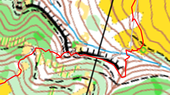
The route I took is in red, and notice how I was able to go no closer to the cliff than exactly where it is marked on the map. The scale of this crop is ~150 ft from the left side to the right.
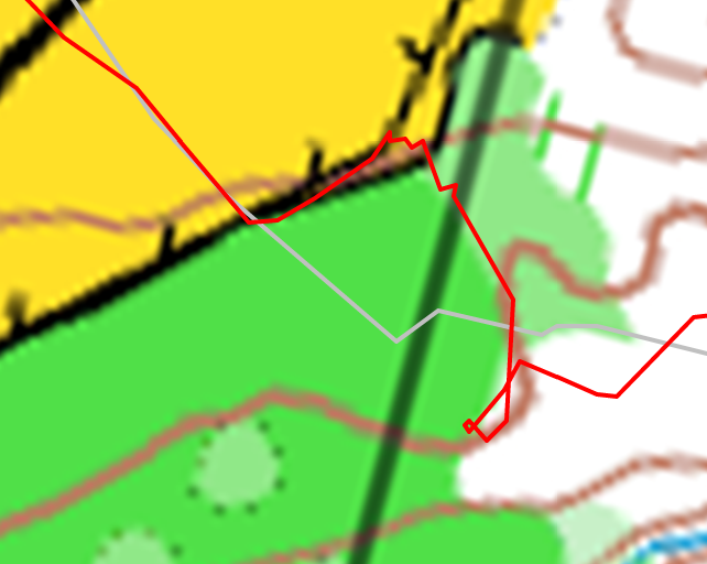
The dark green color on this map represents impenetrable vegetation, and sure enough, I was unable to walk through it. But notice how the path that I find around it exactly traces the marked edge on the map! (Scale is ~50ft from left to right.) The lighter green color wasn’t easy to walk through (or see through) either, but someone did in order to make this map.