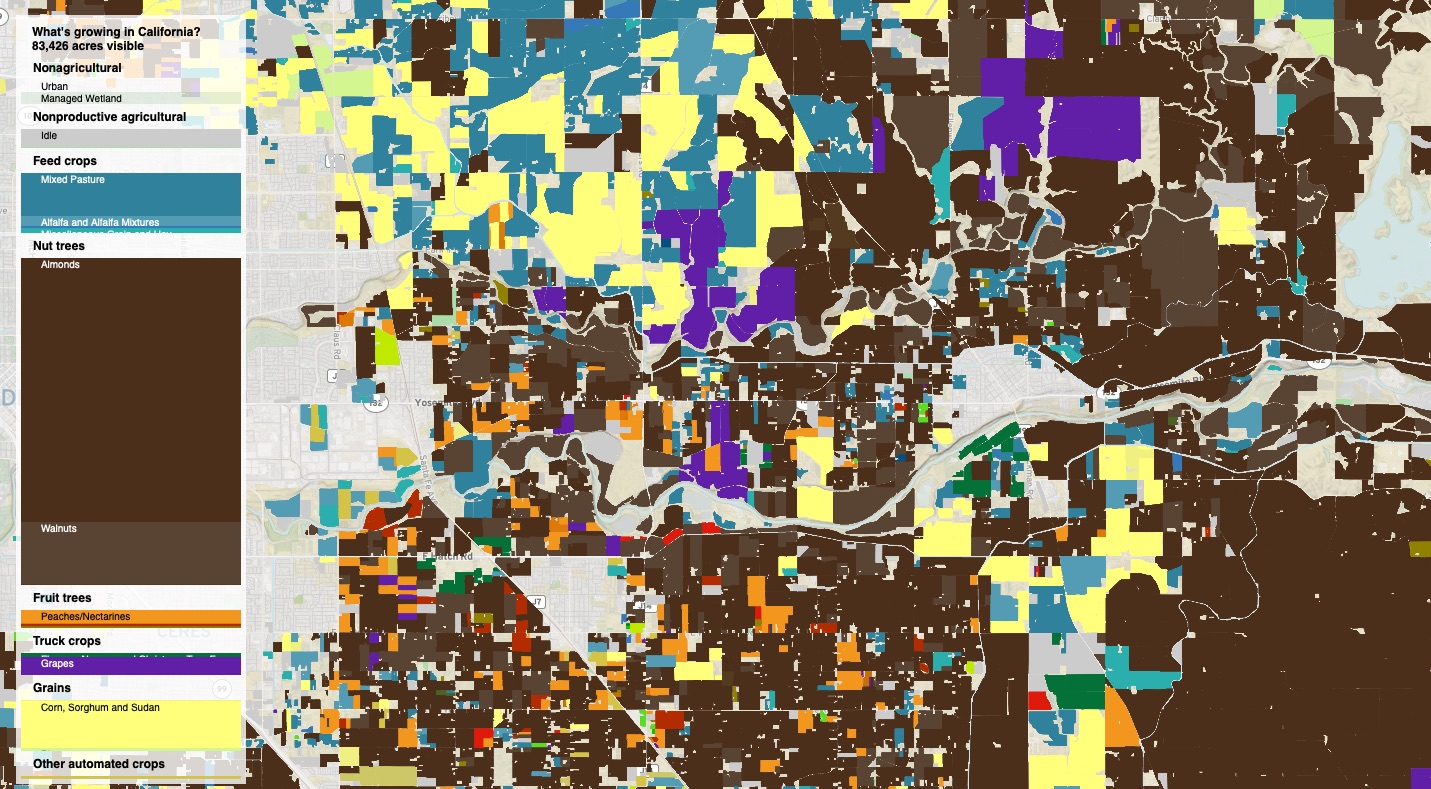
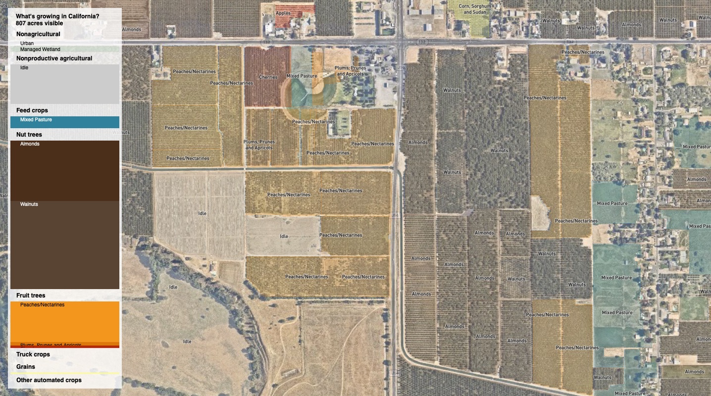
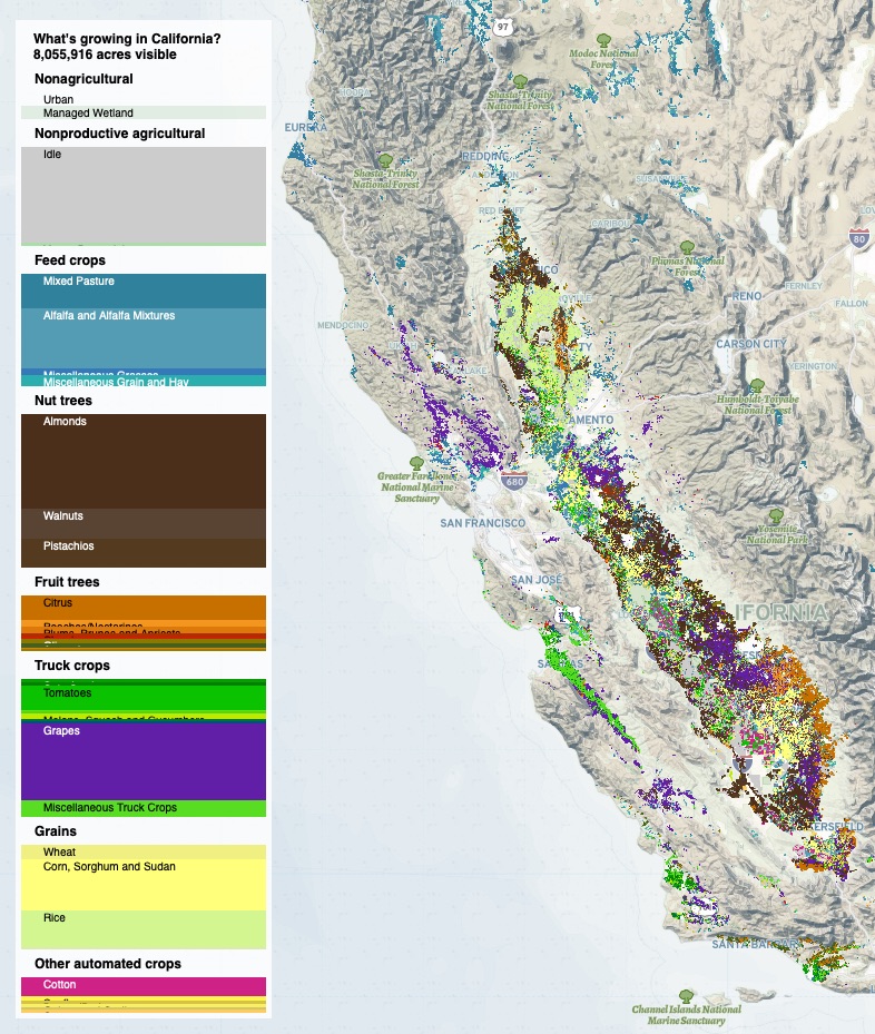
A map of California crop production
I discovered a phenomenal dataset of California agricultural land, identified by crop down to the specific field (sub parcel!) This seemed like the perfect opportunity to stretch some of my map making/map styling/passive interactivity skills.
Also, I just find the regional variation in crops, how in one county you might drive through orchard after orchard of almonds, and then you hit some invisible dividing line and it switches to grapes. Some times these dividing lines are physical, based on soil type or ease of irrigation, sometimes they are cultural, “what do people grow here?”
Making this was also good practice for setting tippecanoe options.