Analyzing the Oakland Police Department's use of helicopters
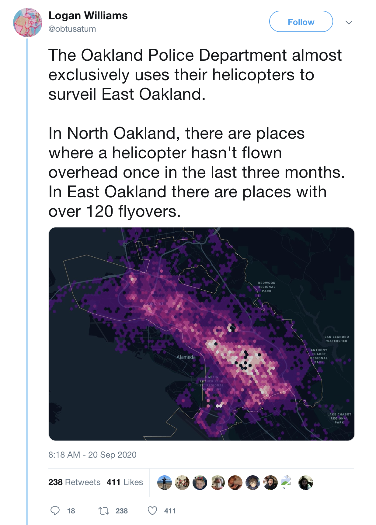
I analyzed historic data from ADS-B Exchange to map out the most common places that Oakland Police Department chooses to deploy their helicopters. The data shows concerning patterns of geographic inequity, with residents of certain neighborhoods forced to deal with the noise and environmental pollution from low-flying helicopters much more than others.
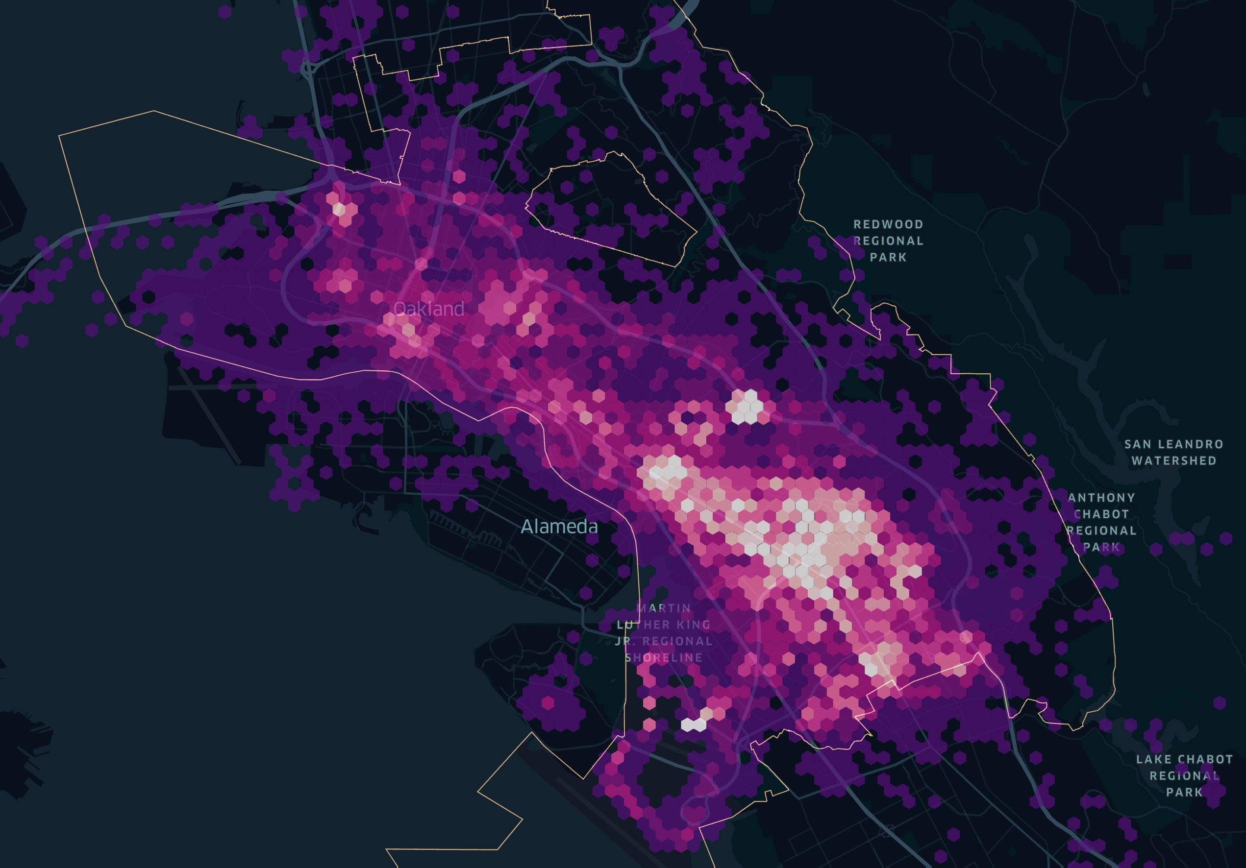
While some of this “merely” reflects the location of the airport and neighborhoods with more police calls, data I FOIAd from the OPD also shows a pattern of pro-active surveillance of low-income neighborhoods.
This map attracted some attention on Twitter. I’ve archived my original post here, as I’ve since deleted all posts from Twitter.